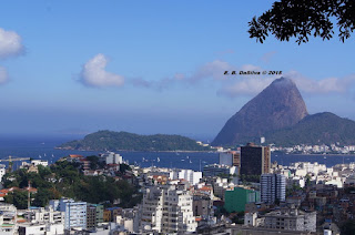
Saturday, April 25, 2015

New Zealand on Top of Two Great Tectonic Plates

Edmar Bernardes DaSilva (MA in Geography - Doctor of Geography Education)
The country of New Zealand is located on the conjunction of two of the Earth's great tectonic plates: the Australian and the Pacific plates. 

The tectonic plates move like hard shells that slide over the surface of the Earth.

Generally speaking, the great Australian plate is moving north while the Pacific plate is moving west. The combination of these movements means that the Pacific plate, which includes most of New Zealand's South Island, is moving in the southwestern direction of the Australian plate at a rate of about 40 millimeters each year. Finally, the city Christchurch is moving away from the city Auckland about 4 meters every century.

Monday, September 3, 2012

World Geography - Geografia Geral

Film by (Film por): Dr. Edmar Benardes DaSilva 

© 2012
All rights reserved
Todos os direitos reservados

Thursday, August 30, 2012

Physical Geography (Geografia Física)

Film By (por): 
Dr. Edmar Bernardes DaSilva
©

© 2012
All rights reserved
Todos os direitos reservados

Monday, December 19, 2011

Wine Producing in Central Florida (Economic Geography)

By Dr. Edmar Bernardes DaSilva with Dr. Robb N. Kvasnak

Visiting Orlando I leaned that Florida also produces wine. I never knew Florida was a wine producer. Believe me it is. The wine region of Florida is located in the Central Highlands a little north of Clermont. Region where the physical geography is made up of rollings hills and a great number or lakes. The winery itself is located at approximately 100 m above sealevel.
Picture of Lakeridge Winery in Central Florida (Near Orlando)


Lakeridge Winery is a lovely place where you can experience wine making, tasting and also can see a closeup of the vines. The winery building reminds you of a house in southern Spain. Inside you will fine loads of local wines and other souvernirs related with wine drinking. Southern Red, which remindes me of the Brazilian wine Sangue de Boi (Ox Blood) and the Portuguese wine Vinho do Porto (Port Wine), Couvé Noir Reserve, which remindes of a wine produced in the upper São Francisco River region in Brazil, Couvée Blanc, Blanc Du Bois, Chablis, Sunblush, Pink Crescendo, Southern White are the wines produced in the winery. They will give you a free tour and wine tasting.

Lakeridge Winery in Central Florida
 
The amazing thing is that the grapes used here, (the Muscadine grapes), are native to North America. Some of the grapes are imported vines that are grafted onto the native American grapes since vines imported from Europe would not survive in the humid and hot climate in Florida.


Copyright © All rights reserved

Monday, October 3, 2011

What We Can do to Slow Down GLOBAL WARMING?

Dr. Edmar Bernardes DaSilva (Masters in Geography and Doctor of Geography Education)
Southern Florida Would be Under Water

Humanity can take action to slow global warming. As researchers have showing global warming results primarily from human activities that release heat-trapping gases and particles into the air. The most important causes include the burning of fossil fuels such as coal, gas, and oil, and deforestation. To reduce the emission of heat-trapping gases like carbon dioxide, methane, and nitrous oxides, we can curb our consumption of fossil fuels, use technologies that reduce the amount of emissions wherever possible, and protect the world’s forests and keep the world crop production stable.
We can also do things to mitigate the impacts of global warming and adapt to those most likely to occur, through careful long-term planning and other strategies that reduce our vulnerability to global warming. The IPCC Special Report on Emission Scenarios determines the range of future possible greenhouse gas concentrations (and other forces) based on considerations such as population growth, economic growth, energy efficiency and a host of other factors. This leads a wide range of possible forcing scenarios, and consequently a wide range of possible future climates. Precipitation is also expected to increase over the 21st century, particularly at northern mid-high latitudes, though the trends may be more variable in the tropics. Snow extent and sea-ice are also projected to decrease further in the northern hemisphere, and glaciers and ice-caps are expected to continue to retreat.
Flood in Bangladesh (Source: www.global-change.com)

Copyright © All rights reserved

Saturday, September 10, 2011

How Geography Sees Tourism

Dr. Edmar Bernardes DaSilva (Masters in Geography and Doctor of Geography Education)


Fernando de Noronha, Brazil 

Geography sees tourism differently from traditional businesses working in the travel industry. The approach of traditional business to tourism is about making profit and being well organized to earn the most profit as possible.On the other hand, TOURISM GEOGRAPHY, studies the tourism phenomenon on both: the geographic location where tourism is practiced, and also leading a close link of touristy experience with the geographical natural and cultural landscapes present at the touristy destination. Geography’s study of tourism in reality starts focusing on the input of natural and cultural landscapes (or elements) that the geographic background of a tourist destination is made up of. After all the mentioned above is done questions like the ones below are asked:

Ipanema Rio de Janeiro Brazil (An international touristic Mecca)

- How will tourists in reality experience the physical (natural) and cultural (men-made) imprints of the geographical destination?

- What mental maps of the culural and physical landscapes might the tourist have internalized (pictures and anticipations) that will fill their minds with the natural and cultural elements of the tourist destination?

- What arrangement and visual representations will successfully permit the traveler to extensively enjoy and remember the tourist destination’s exclusive natural and cultural geographies.


The tourism geography method gives us a good example of the relevance of human geography in the field of geography. When a student specializes in tourism geography (with a concentration), this student will be prepared to be a tourism geography specialist.
Capocabana Rio Brazil

Tourism Geography Major’s Specific Objectives:

- Students who finished their concentration on TOURISM GEOGRAPHY must have an excellent understanding of geography (cartographic, physical and human). The TOURISM GEOGRAPHY majors need to learn not only basic geographical locations, but also have a deep understanding of the connections between humans and the physical environment where they live in.
Paris France another international touristic Mecca

- TOURISM GEOGRAPHY majors must graduate with a profound understanding of the philosophy, behavioral characteristics, impacts (e.g. economic impacts), capacity (e.g. carrying capacity), sectors, innovations, technological advances, tourism growth projections, and historical background of the tourism process (could be local, regional and at national levels). Learn how tourism effects and is effected by the human geography of a region, and also how tourism effects and is effected by the physical geography of a region.
The River Rhine in Germany (A hot touristic spot in Germany)

- All students when finished completing TOURISM GEOGRAPHY must have a solid understanding of the significance and prospects of what is to be a TOURISM PROFESSIONAL, and have the ability to understand the PRATICE OF PROFESSIONAL ETHICS. They must have a good to excellent ability in creative oral and written communication, and finally have a great knowledge of how to be a presenter (e.g. at a conference).

Pictures by Edmar Bernardes DaSilva, MA and ED.D. and Robb Kvasnak MA and Ed.D.
Copyright (Direitos Autorais) © All rights reserved (Todos os direitos reservados)

Tuesday, August 16, 2011

The Mighty Amazon River in South America

Dr. Edmar Bernardes DaSilva (Masters in Geography and Doctor of Geography Education)

The mighty Amazon River is 6280km long. The river starts in Peru as very small stream. It becomes gigantic inside Brazil (where most of it is located) and the mouth and Delta of the Amazon River is located in Northern Brazil (Pará state).


The Amazon River is the world's second longest river. Only the Nile River, in Africa, is longer. Of all rivers in the world, the Amazon River is the most imposing. In fact, the amount of water the Amazon River carries out to sea is estimated at 20% of all the freshwater that is discharged into the oceans.


The Amazon is not the longest, but it is the widest of them all. The Amazon River collects water from over 40% of South America's Landmass, through the thousands of tributaries that join the main branch of the Amazon River.

News on the Amazon River: scientists at the University of Liverpool discovered that the Amazon River is 11 millions years old (Source: TopNews.in)

Copyright © 2011

Monday, July 25, 2011

BIOGEOGRAPHY

Dr. Edmar Bernardes DaSilva (Masters in Geography and Doctor of Geography Education)
Water fall in Brazil

Biogeography is the science, which aims to study and comprehend the geographic distribution of diverse biomes of the earth. So, biogeography studies the distribution of organisms from the ancient earth to the present-day earth, and analyzes the connected prototypes of variations of living things. Biogeographers study where all species are located, why they are there, and where the greatest concentrations of species are. The study of biogeography is the answer of questions important for the Earth’s biogeographical knowledge and preservation. Answering questions like: Do we feed ourselves with these species? Do they give us shelter? Do they produce medications that help cure diseases? Do they produce oxygen, provide fuel and filter the water we drink? The climate change that is producing global warming makes it even more important to understand the enormous diversity of the Earth’s fauna and flora in order to understand the impact of environmental changes on terrestrial biogeography.

Biogeography tries to examine a variety of concepts of species’ spatial distribution and profusion (why they are there and what they do to the environment).
Canadian Fauna

A major concept studied in biogeography in these days is the ‘centers of endemism’. This kind of study gives us answers about why are species limited to a geography niche, and where this geographical niche is located. Biogeographers are mapping those biogeographical regions both on global and regional scales. Finally, endemism happens when species or other taxonomic groups are limited to a specific biogeographical region due to aspects like separation or response to soil or climate circumstances.


Copyright © All rights reserved

Saturday, July 23, 2011

Physical Geography - The Plate Tectonics

Dr. Edmar Bernardes DaSilva (Masters in Geography and Doctor of Geography Education)


Alfred Wegener: The Father of the Plate Tectonics Theory
  (German Climatologist and Geophysicist)

The plate tectonics theory is the scientific theory which explains that the Earth is made of big chunks of the Lithosphere. The theory was created based on the old concept of continental drift developed by the German scientist Alfred Wegener during the first decades of the 20th century, and was welcomed by the majority of geoscientist during this time. Wegener as a meteorologist proposed tidal forces and pole flight force as the major forces causing continental drift. The scientific community of this time believed that these forces were too small to cause montion of the continental crust. Later in 1929 Wegener in the last publication of his book he changed to convection currents as the major driving force causing continental drift
Making it easier for the reader to understand: the LITHOSPHERE is divided into what we call TECTONIC PLATES. Out there we have seven to eight major plates, and all depends on how the plates are defined. But also a great number of minor plates (e.g. Scotia Plate near Antarctica). The TECTONIC PLATES (or lithospheric plates) float on the ASTHENOSPHERE.
                                           Earth Layers
The plates’ movements happen in relation to each other. The tectonic plates have three types of boundaries:
-      Convergent
-      Divergent
-      Transform
  Major Plate Tectonics Boundaries (Source: The US Geological Survey)

To end this short article on plate tectonics you should learn that volcanic activites, earthquakes, oceanic trenchs formantion, and mountain-building take place on the length of these plates’ boundaries. The plates are compose of two types of LITHOSPHERE: the thick continental lithosphere, and the thin oceanic lithosphere. The superior part is called the crust (the crust can be continental and oceanic).

Finally, the theory of continental drift proposed by the meteorogist Alfred Wegener in1912, and expanded in his book The Origen of the Continents published in 1915 started the debate, which fifty years later gave us the THEORY OF THE PLATE TECTONICS.

Copyright © All rights reserved (2007)

Thursday, July 21, 2011

Why Study Geography?


Dr. Edmar Bernardes DaSilva (Masters in Geography and Doctor of Geography Education)

Geography in reality has a utilitarian value in the modern world. As the interconnectedness of the world accelerates the practical need for geographic knowledge becomes more critical and extremely necessary. Imagine a doctor who treats diseases without understanding the environment in which the diseases thrive and spread, or a manufacturer who is ignorant of world markets and resources, or a postal worker who cannot distinguish Guinea from Guyana or Austria from Australia. With a strong grasp of geography, people are better equipped to solve issues at not only at the local level but also at the global level. A lot people still do not understand that we live in a Global Village and the interconnection is impossible to stop.

Then you read in the news that a president of a country confuses Austria and Australia or the economic data from one country with another one or even confuses cultural life styles of one country and another which many times offends people that are proud of their language and cultural make up. A typical American geographical mistake is to confuse Rio de Janeiro as the capital of Argentina and Buenos Aires as the capital of Brazil. A statesman who arrives in a country and doesn’t know what country he is in and how he got there should not be a statesman at all, because his position already implies that he needs to know the geography (physical, cultural, political, economic...) of his country and also the entire world.

In short, all themes and concepts of geography are very useful and important in our everyday life, and when you take your learning of geography for granted, you are a candidate to become a world affairs illiterate, who will always confuse Portuguese and Spanish, German and Dutch, Austria and Australia and so on.
Physical Geography

Cartography - GIS and Remote Sensing

Biogeography

Human Geography

Copyright © All rights reserved

Saturday, July 9, 2011

Urban Geography (Geografia Urbana)


Rio de Janeiro - Brazil

Dr. Edmar Bernardes DaSilva (Masters in Geography and Doctor of Geography Education) 

When the word geography is mentioned, most of the people who are not geographers or professionals but who are connected with geography relate the discipline directly to maps and places. Most of the ordinary people do not know that geography is more than looking at maps and finding locations. Most of them don’t know that geography is composed of different fields e.g. Physical Geography and sub-fields e.g. Urban Geography is a sub-field of Human Geography.

Urban geography the subject of this short article is the study of the geography of cities (or you can say the study of urbanized regions of the globe). Even Urban Geography is a sub-field of Human Geography and has its own complexity.
Partial View of Luz Brazil - Small Town in Southern Brazil
(Foto by Lucas Oliveira Santos)

Urban Geography studies the areas, which have a large concentration of buildings and a complex infrastructure. They are areas where the major economic activities are connected to the secondary and tertiary sectors. Because of all above they would have a large population concentration. Urban geography has some connections with anthropology and sociology, what means that it can have common characteristics with those fields. Urban geographers in general look to study and understand how factors are connected spatially, how they function and the relationship among them. Urban geographers also seek to understand the settlements’ development (e.g. the expansion of an urban area and improvements made). Urban geographers also try to study the human environmental impact of the changes mentioned above.
Savannah - The USA

Copyright © All rights reserved

Thursday, June 30, 2011

A Little Bit of Geography

South America - Physical Map (Cartography)

Dr. Edmar Bernardes DaSilva (Masters in Geography and Doctor of Geography Education)

First, for the purpose of this article the term geography must be defined. Geography is an integrative discipline that brings together the physical and human dimensions of the world in the study of people, places, and environments (Geography for Life, National Geographic Society, 1994 in Mansfield, 2005).
Geography is one of the oldest of the sciences and scholarly disciplines. ­Like astronomy, geography is concerned with the content of space. ­It may be said that geography has a shared common origin with astronomy.
The peak of Geography’s relative importance as a discipline among sciences came in the period of the great explorations (from the 15th century into the 19th century: Vasco da Gama…).
Early Greeks geographers who first gave structure to geography. Eratosthenes (276 BC - 194 BC) the father of classical geography, was the first to coin the word geography. He paved the way in the study of the earth . ­He was born in the Greek colony of Cyrene in Libya. He wrote a book describing the ekumene, the inhabited earth, in which he accepted both the major divisions of Europe, Asia, Libya, and the five zones: a Torrid Zone, two Temperate Zone, and two Frigid Zones. ­Started his education in Cyrene and later in Athens. ­Eratosthenes died at the age of 80. ­Is to this day one of the greatest geographers of all ages.

Modern geography had its origin in the surge of scholarly inquiry that, started in the 17th century Germany: important place for the development of modern geography. Germans are in reality the fathers of modern geography, and the greatest German geographer was Alexander von Humboldt (1769-1859). Regarded as the father of modern geography. Von Humboldt studies, travels and scientific wisdom transformed natural science in the nineteenth century.

Why learn geography? What can I do with geography?

   Ouro Preto Brazil - A Cultural Landscape (Urban Geography)

Geography has useful value in the modern globalized world. As the linkages of the world accelerates the realistic need for geographic knowledge (geographical education) becomes more serious. Think about a doctor who treats diseases without understanding the geographical environment in which the diseases flourish and proliferate, or a manufacturer who is ignorant of world markets and resources, or a postal worker anywhere who cannot differentiate Austria from Australia. With a strong understand of geography, people in general are better equipped to solve issues at not only at the local level but also at the regional, national and global levels.

Fields of Geography

Earth Systems Science (Physical Geography)Focuses on research and education dealing with Earth’s dynamic processes, materials and physical properties (weather, climate, geology, landforms and landscapes, soils and bioregions).

Human-Environment Systems Science (Human Geography)Focuses on the measurement, analysis and modeling of human and environmental systems
and their interactions at various spatial and temporal scales.

                         Rice Fields in India (Economic Geography)

Subfields of Human Geography:
Cultural Geography
Economic Geography
Urban Geography
Political Geography
Environmental Geography

Tourism Geography
Population Geography...

   Population Pyramids of the USA/2010 (Population Geography)

Geo-Information Science (Cartography)
This area emphasizes analytical techniques suited to the understanding
and modeling of the Earth and human phenomena.


The five Fundamental Themes of geography are summarized by a joint committee of the National Council of Geographic Education and the Association of American Geographers:

LocationThe meaning of relative and absolute position on the earth’s surface.
Lines of Latitude and Longitude (Source: Online Geography Resources)

                       Mongolia (A Place on Earth)

Place:The distinctive and distinguishing physical and human characteristics of locales.

Relationships within places: The development and consequences of human-environment relationships.

MovementPatterns and change in human spatial interaction on the earth.

RegionsHow they form and change.
                              World Regions

Copyright © All right reserved/July-2007

Friday, June 17, 2011

Physical Geography


Dr. Edmar Bernardes DaSilva (Masters in Geography and Doctor of Geography Education)

Physical geography is the study of the natural landscapes on the face of the Earth, better defined as the study of the conditions of the natural landscapes. Physical geography involves Water Resources (water resources on land: rivers, lakes...), Palaeogeography (studies of ancient geologic environments), Geomorphology (studies of landforms and the processes that shape them), Oceanography (studies of the Earth’s oceans), Pedology (studies of the soil), Glaciology (studies of natural phenomena involving ice - glaciers), Biogeography (studies of the distribution of species on Earth), Climatology (studies of the climate), and Landforms (highlands, lowlands, plateaus...).

Physical geography also concentrates on the physical analysis of the Earth’s crust and the influence of humans on that crust. As everyone knows humans are the major forces that change the Earth’s surface. Humans are constantly modifying the Earth’s natural environments and shaping it according to their desire. In the process biomes are destroyed and natural landscapes re-shaped to become a cultural landscape.

Some Important Sub-fields of Physical Geography:
The Brazilian Highlands 

Geomorphology: the area of physical geography which is concerned with the understanding of the Earth surface and all processes that shapes it (present processes and past processes)

Hydrologyis concerned with the quality and amounts of water moving and accumulating on the land surface and in the soils and rocks near the surface (Hydrological Circle)
Water Fall in Minas Gerais - Brazil

Glaciology: the study of glaciers and ice sheets and the phenomena that involves ice
Perito Moreno in Argentina

Biogeography: deals with the geographic distribution of species and the processes that results in the patterns


Climatology: the study of the weather and climate (weather conditions over a long period of time)

Palaeogeography: the study of the continents through geological time examining preserved material
Map of Major Plate Tectonics

Coastal Geography: is the study of the dynamics between the land and the ocean
Florida's coastal region

Oceanography: Studies the Earth oceans and seas


Environmental Geography: worries about the human interactions with the natural world
Lake in Florida

Copyright © All rights reserved